Current Research Projects

Jacob research group banner

Last Updated: December 27, 2023

Our research focuses on better understanding the chemical composition of the atmosphere, its perturbation by human activity, and the implications for life on Earth. We use advanced models of atmospheric chemistry to interpret observations from satellites, aircraft, ground networks, and other platforms. We view our models as part of an integrated observing system to increase fundamental knowledge of atmospheric chemistry and address pressing environmental issues.

We have a large number of ongoing projects at any given time, organizaed by sub-groups :

  • Air Quality & Chemistry - Leaders: Ruijun Dang, Xu Feng, Yujin Oak
  • Climate & Health - Leader: Loretta Mickley
  • Methane - Leaders: Zichong Chen, Daniel Varon
  • Model Development and Software Tools - Leaders: Lizzie Lundgren, Melissa Sulprizio, Bob Yantosca
  • Retrieving Point Sources from Satellites - Leader: Daniel Varon
  • Statistical Learning in Atmospheric Chemistry (SLAC) - Leaders: Daniel Varon, Drew Pendergrass
  • Diversity, Inclusion, and Belonging  - Leaders: Nadia Colombi and Drew Pendergrass

Air Quality and Chemistry

subgroup leaders: Ruijun Dang, Xu Feng, Yujin Oak

Air Quality in China and Korea

Background

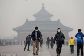
China and Korea have a very severe particulate matter (PM) and ozone air pollution problem. Surface air quality networks together with satellite and aircraft allow us to track changes in air quality and the responses to emission controls, to better understand the chemical processes controlling PM and ozone formation, and to guide future emission control strategies.


Objectives

  • Understand the effects of anthropogenic emissions, chemical processes, and other factors in determining ozone and PM air quality and its trends in China and Korea;
  • Exploit observations from the new GEMS geostationary satellite instrument;
  • Develop a satellite-based monitoring system for air pollution in China and Korea.

Approach

  • Analyze observations from air quality networks, field campaigns, and satellites to gain insight into the processes controlling PM and ozone;
  • Use machine learning applied to satellite observations to develop a monitoring system for air quality;
  • Improve the retrievals and interpretation of GEMS observations;
  • Review the knowledge of air quality and trends in Korea with new insights from satellite observations.

People

References

Support

  • JLAQC
  • Samsung
  • NSF Fellowships to Nadia Colombi, Drew Pendergrass, Laura Yang

Collaborators

  • Ke Li and Hong Liao (NUIST)
  • Jhoon Kim (Yonsei)
  • Soontae Kim (Ajou U.)

Particulate nitrate

BackImage result for Seoul air qualityground

Nitrate is a major component of particulate matter (PM) pollution. It is produced from the oxidation of nitrogen oxides (NOx) emitted by combustion, but also depends on ammonia emitted by agriculture as well as other species through complicated chemical interactions. Decreases in NOx emissions have often not been successful at decreasing particulate nitrate.  Better understanding  is critical for achieving PM air quality standards.

Objectives

  • Interpret and model nitrate observations from air quality networks and field campaigns to better understand the driving processes determining nitrate concentrations;'
  • Diagnose the response of nitrate to emission changes in different parts of the world.

Approach

  • Use satellite observations of NO2 and NH3 to diagnose whether nitrate information at a particular location is limited by emissions of NOx or NH3;
  • Interpret long-term nitrate trends from air quality networks.

People

References

Support

  • JLAQC
  • Samsung

Collaborators

  • Martin Van Damme, Lieven Clarisse, Pierre Coheur (ULB)

Tropospheric ozone

Background

Tropospheric ozone is a central species for atmospheric chemistry. It affects air quality, it is a major greenhouse gas, and it controls the oxidizing power of the atmosphere.  Ozone is produced by photochemical oxidation of CO and volatile organic compounds (VOCs) in the presence of NOx, and is also transported from the stratosphere. It is lost by deposition and by photochemical processes including halogen chemistry. The chemistry interacts with transport on all scales, making for a very complicated problem that current models still struggle with. Tropospheric ozone is presently rising but we dont understand why.

Objectives

  • Better understand the factors controlling tropospheric ozone;
  • Understand the origin of the elevated ozone background and its trend over East Asia;
  • Examine the effects of unconventional chemistry.

Approach

  • Evaluate the effects of particulate nitrate photolysis and halogen chemistry on the GEOS-Chem ozone simulation;
  • Use GEOS-Chem to interpret tropospheric observations from sondes, aircraft, and satellite over East Asia, and their trends;
  • Intercompare GEOS-Chem and CAM-chem ozone simulations in the same CESM Earth system model environment;

People

Collaborators

  • Christoph Keller (NASA GSFC)
  • Louisa Emmons (NCAR)

References

Support

  • NSF
  • Samsung
  • JLAQC
  • NSF Fellowship to Nadia Colombi

Organic chemistry

Background

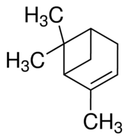
The atmospheric chemistry of volatile organic compounds (VOCs) has major implications for oxidant concentrations and for formation of secondary organic aerosol (SOA). VOCs are emitted from many different sources. They undergo various oxidation cascades in the atmosphere, producing increasingly substituted and cleaved species. These species may condense to form SOA and subsequently react in the aerosol phase. Most of the species and reactions involved have never been measured and must be inferred indirectly. Comparisons of model and observations can show order-of-magnitude differences. This is one of the big frontiers of knowledge in atmospheric chemistry.

Objectives

  • Develop state-of-science chemical mechanisms for atmospheric organics that can be practically implemented in models;
  • Determine the implications of these mechanisms for ozone, OH, aerosols;
  • Improve understanding of the budgets of oxygenated organics.
  • Use peroxyacetylnitrate (PAN) as tracer of ozone pollution.

Approach

  • Evaluate VOC oxidation mechanisms in GEOS-Chem;
  • Investigate missing processes responsible for large discrepancies of models with observations;
  • Determine the implications for oxidant and aerosol chemistry;
  • Evaluate model PAN with new satellite observations and use it as a tracer of ozone chemistry

People

Collaborators

  • Bruno Franco, Lieven Clarisse, Pierre Coheur (ULB)

References

Support

  • EPA
  • NASA ACCDAM
  • NSF Fellowship to Laura Yang

Observing NOx point sources from satellites

 emergency-usa.blogspot.com Background

Power plants are large point sources of nitrogen oxides (NOx = NO + NO2), a major pollutant.  Emissions can be highly variable depending on fuel, operating conditions, and NOx capture devices. Current satellite instruments designed to observe NO2 have pixel resolutions of a few km, insufficient to resolve point sources from power plants. Land surface imagers have considerably finer pixel resolution but have not been used yet for observing NO2. 

Objectives

  • Develop the capability to quantify NOx emissions from point sources using surface imaging satellite instruments;
  • Determine the resulting potential for monitoring NOx emissions and their long-term trends from space.

Approach

  • Use Sentinel-2 and Landsat observations of UV/Vis solar backscatter radiances to retrieve NO2 vertical columns;
  • Infer NOx emissions from the observed plumes.

People

References

Support

  • GHGSat, Inc.

Collaborators

  • Dylan Jervis (GHGSat)

Geostationary observation of US air quality

tempoBackground

The TEMPO geostationary satellite instrument launched in April 2023 is now providing continuous observations of US air quality. This offers a unique resource to better understand the emissions, transport, and chemistry of air pollution in the US, as well as the role of background sources.

Objectives

  • Validate the TEMPO observations;
  • Exploit the TEMPO observations to evaluate current emission inventories and the contributions of background sources to US air quality.

Approach

  • Apply machine learning to calibrate TEMPO observations to other more established satellite data;
  • Apply the CHEEREIO localized transform ensemble Kalman filter to quantify NOx emissions from the TEMPO observations; 
  • Use cloud slicing to determine the free tropospheric background contribution to tropospheric NO2 columns.

People

Collaborators

  • Xiong Liu and Kelly Chance (Harvard-Smithsonian)

Support

  • JLAQC
  • NASA

Effect of H2 economy on atmospheric chemistry and climate

IMI logoBackground

Molecular hydrogen (H2) is of considerable interest as a clean renewable fuel.  However, there is concern that leakage of H2 could contribute to greenhouse warming not directly (H2 is not a greenhouse gas) but indirectly by affecting tropospheric OH and ozone. This hinges on chemistry that is not well represented in models and better understanding is needed. 

Objectives

  • Evaluate the capability of the GEOS-Chem global atmospheric chemistry model to simulate observed OH reactivity, which is key to understanding the effect of H2 on OH;
  • Use GEOS-Chem to quantify the impacts of increased H2 on tropospheric ozone, methane lifetime, and stratospheric water vapor;
  • Determine the implications for the global warming potential of H2.

Approach

  • Simulate OH reactivity observations from the ATom and other aircraft campaigns in different regions and seasons;
  • Conduct GEOS-Chem simulations with perturbed H2 concentrations;
  • Implement an explicit H2 simulation in GEOS-Chem.

People

Collaborators

  • Katie Travis (NASA LaRC)
  • Bryan Mignone (Exxon-Mobil)

Support

  • Exxon-Mobil
  • NASA ACCDAM
  • NSF Fellowship to Laura Yang

Climate and Health

subgroup leader: Loretta Mickley

Loretta Mickley: Research Page

See Loretta Mickley's research page. Students/postdocs working on chemistry/climate interactions, effects of fires on air quality, and connections to public health generally have Loretta Mickley as primary research advisor. (Eimy BonillaPengfei LiuTianjia (Tina) LiuJonathan Moch, Miah Caine, Kent Toshima)

Methane

subgroup leaders: Zichong Chen and Daniel Varon

Detecting methane point sources from satellites

Background

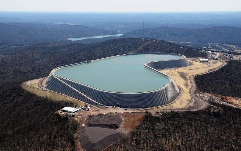
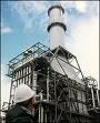
Anthropogenic emissions of methane originate from a very large number of individually small point sources including coal mine vents, oil/gas production and processing facilities, stockyards, landfills, etc. These sources have highly variable emissions, and can spike under abnormal conditions.  Satellites provide a unique vantage point for detecting the atmospheric plumes originating from large point sources and thus enable  action to shut down these emissions.

Objectives

  • Develop methods for detecting and retrieving atmospheric methane plumes from fine-scale satellite data;
  • Infer point source emissions from the plume observations;
  • Relate point source emissions to operating variables in order to understand the factors driving emissions.

Approach

  • Determine the ability of new satellite instruments to detect methane plumes ;
  • Use machine-learning methods to automate methane plume detection and source rate quantification;
  • Use over-sampling of TROPOMI satellite observations to detect and quantify point sources;
  • Use point source activity data to interpret the source rate observations and improve emission inventories.

People

Collaborators

  • Itziar Irakulis-Loixalte, Marc Watine (IMEO)
  • Jason McKeever, Dylan Jervis (GHGSat, Inc.)
  • Lauri Myllivarta (CREA)
  • Dan Cusworth (Carbon Mapper)

Support

  • GHGSat, Inc.
  • Global Methane Hub
  • Carbon Mapper

References

Constructing methane emission inventories

Background

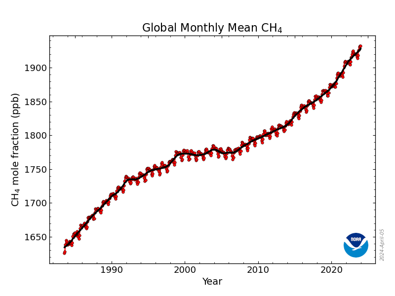
Methane is the second most important anthropogenic greenhouse gas after CO2. It is particularly important for near-term (~20 years) climate change. Methane is emitted by a wide range of processes including oil/gas systems, livestock, landfills, wastewater, rice cultivation, and wetlands. The magnitudes of these sources, their spatial distributions, and their temporal trends are poorly understood. Improving the "bottom-up" inventories that relate emissions to activity levels is imperative for climate policy. This can be done by using new activity and emission factor data, evaluating the resulting inventories with atmospheric observations through "top-down"inverse analyses, and using the results of these inverse analyses to further improve the emission inventories. This partnership between bottom-up and top-down approaches is key to improving understanding of methane emissions in a way that can enable policy action. It requires bottom-up inventories with high spatial resolution that can serve as prior estimates in inversions of atmospheric observations.

Objectives

  • Develop policy-relevant bottom-up methane emission inventories with high spatial resolution that can be evaluated with top-down analyses.

Approach

  • Develop the Global Fuel Emission Inventory (GFEI) to spatially allocate the emissions reported by individual countries to the United Nations Framework Convention on Climate Change (UNFCCC);
  • Develop a spatially resolved version of the US EPA Greenhouse Gas Inventory (GHGI);
  • Use satellite observations of point sources to construct an improved coal emission inventory for China;
  • Use Landsat observations to construct global spatially resolved inventories of emissions from rice and wetlands.

People

Collaborators

  • Tia Scarpelli (Carbon Mapper)
  • Bram Maasakkers (SRON)
  • Lauri Myllivarta (CREA)
  • Melissa Weitz (EPA)
  • Mark Omara (EDF)

References

Support

  • NASA CMS
  • UNEP
  • Global Methane Hub

Improving urban, regional, and national inventories using satellite data

Bac www.nytimes.comkground

Atmospheric observations of methane from satellites can provide powerful top-down information for evaluating the national emission inventories used in climate policy and reported to the United Nations Framework Convention on Climate Change (UNFCCC) under the Paris Agreement.  Exploiting this information involves statistical inversion of chemical transport models that relate emissions to atmospheric concentrations.  

Objectives

  • Use satellite and surface observations to quantify and attribute methane emissions on urban, regional, and national scales;
  • Exploit this top-down information to improve bottom-up emission inventories .

Approach

  • Improve the quality of TROPOMI satellite retrievals of atmospheric methane using machine learning;
  • Use TROPOMI satellite observations to quantify methane emissions at the scale of individual countries and source regions;
  • Exploit this top-down information to improve the bottom-up national inventories;
  • Use a new 12-km resolution version of GEOS-Chem to optimize methane emissions at urban scales;
  • Develop new inverse methods to improve the power of atmospheric methane observations for quantifying methane emissions.

People

Collaborators

  • Ritesh Gautam (EDF)
  • Felipe Cardoso Saldana, Emily Reidy, Bryan Mignone (Exxon-Mobil)
  • Dan Zimmerle (CSU) and Ken Davis (Penn State)

References

Support

  • NASA CMS
  • Exxon-Mobil
  • UNEP
  • EDF
  • NSF Fellowship to Sarah Hancock
  • NDESG Fellowship to Nicholas Balasus

Explaining the global budget and the rise in methane

Background

The atmospheric methane concentration has tripled since pre-industrial time and this growth has accelerated over the past decade. Reversing this trend is crucial for limiting warming below 2 degrees of danger but the drivers of the trend are not understood.  Methane is emitted by a large number of sectors (wetlands, livestock, oil/gas operations, landfills, coal mines, wastewater treatment, rice paddies...) and is removed from the atmosphere by oxidation by the OH radical. All these factors could contribute to the methane trend.  

Objectives

  • Better understand the global budget of methane including the contributions from different source sectors;
  • Better understand stratospheric methane and its contribution to the atmospheric methane columns measured from space;
  • Understand the methane trend over the past decade including the recent acceleration;
  • Determine the role of OH concentrations in driving the methane trend. 

Approach

  • Use inversions of long-term satellite observations to attribute global methane trends and the recent acceleration;
  • Apply a new TROPOMI data set to global methane inversions for better separation of source sectors and the role of OH;
  • Evaluate the GEOS-Chem simulation of stratospheric methane and the implied biases in global methane inversions;
  • Exploit the information contained in the latitude-dependent seasonality of methane;
  • Develop methods to separate the influences of methane sources and sinks in global inversions of satellite data, and apply them to infer trends in OH concentrations;
  • Implement the GEOS-Chem transport model and analytical methane inversion methods in the NOAA Carbon Tracker system.

People

Collaborators

  • John Worden (JPL)
  • Lori Bruhwiler (NOAA)

References

Support

  • NASA CMS
  • NOAA

Near-real-time methane emission monitoring system


All imagesBackground

Satellites provide near-real-time global observations of atmospheric methane to enable a system for continuous monitoring of methane emissions.  Such a system will allow fast reporting of emission trends in support of climate policy and the fast identification of emission hotspots for prompt remedial action.

Objectives

  • Enable continuous near-real-time automated monitoring of methane source regions using area flux mappers and point source imagers;
  • Develop a global monitoring system for methane emissions.

Approach

  • Apply a Kalman filter system to weekly update of emissions from source regions using TROPOMI observations;
  • Appply a Local Ensemble Transform Kalman Filter (LETKF) as global continuous inversion system for methane emissions;
  • Extend inversion capability down to 12-km resolution for monitoring of urban emissions;
  • Develop an integrated inversion system for TROPOMI and MethaneSat for monitoring of emissions from oil/gas fields

People

Support

  • EDF
  • Harvard Methane Initiative
  • NSF Fellowship to Drew Pendergrass

Collaborators

  • Ritesh Gautam (EDF)
  • Carrie Jenks (Harvard Law School)

References

Model Development and Software Tools

subgroup leaders: Lizzie Lundgren, Melissa Sulprizio, and Bob Yantosca

GEOS-Chem for weather/climate models and data assimilation

Background

Simulation of atmospheric chemistry in weather and climate models has generally been rudimentary.  Using the  GEOS-Chem chemical module within these models to simulate chemical evolution (including emissions, chemistry, and depostion) provides a state-of-science atmospheric chemistry capability that is referenceable, easily maintained, and has large community backing. 

Objectives

  • Implement GEOS-Chem as a chemical module in weather and climate models, using exactly the same scientific code base as in the off-line GEOS-Chem chemical transport model;
  • Exploit this capability in the NASA GEOS meteorological model for global atmospheric composition analysis and forecasting;
  • Exploit this capability in the NCAR CESM model for study of chemistry-climate-ecosystems interactions.

Approach

  • Contribute to development of the NASA GEOS composition forecasts (GEOS-CF) powered by GEOS-Chem;
  • Develop the GEOS-Chem interface with CESM, and compare GEOS-Chem and CAM-Chem atmospheric chemistry simulations within the same CESM framework;
  • Evaluate transport errors associated with off-line models through comparison of on-line and off-line transport tracer simulations.

People

Collaborators

  • Seb Eastham  and Arlene Fiore (MIT)
  • Steven Pawson, Christoph Keller, Emma Knowland (NASA/GSFC)
  • Louisa Emmons (NCAR)

References

Support

  • NSF
  • NASA GMAO

GEOS-Chem modularization

Background

Atmospheric chemistry models include a large number of modules to describe the evolution of concentrations including emissions, transport, radiation, numerical integration of chemical mechanisms, and wet and dry deposition. Separating these modules to enable plug-and-play (i.e., mix-and-match) of modules from different models can advance the general capabilities of atmospheric chemistry models, both off-line and within the context of Earth system models. GEOS-Chem has powerful modules that can be shared with the community, and can also gain from other community modules. We have already developed stand-alone modules for GEOS-Chem emissions (HEMCO) and for numerical integration of chemical kinetics (KPP 3.0), and are presently developing modules for photolysis and aerosol thermodynamics.

Objective

  • Enable plug-and-play approach to atmospheric chemistry modeling through development of stand-alone GEOS-Chem modules

Approach

  • Modularize GEOS-Chem components to enable their inclusion in other models;
  • Contribute to the NCAR MUSICA next-generation representation of atmospheric chemistry in the NCAR CESM.

People

Collaborators

  • Rolf Sander (MPI)
  • Michael Prather (UC Irvine)
  • Louisa Emmons (NCAR)

References

Support

  • EPA
  • NSF
  • NASA GMAO

GEOS-Chem development and management

GEOS-Chem logoWe develop, maintain, and support the GEOS-Chem atmospheric chemistry model for a user community of hundreds of research groups worldwide and in collaboration with Randall Martin's group at Washington University. Click on the GEOS-Chem logo for more information.

People

Support

  • NASA ACMAP
  • NASA AIST
  • JLAQC

Collaborators

  • Randall Martin, Yidan Tang (Washington U.)

References

Local Ensemble Transform Kalman Filter for GEOS-Chem (CHEEREIO)

observing systemBackground

Satellite observations of atmospheric chemistry provide massive amounts of data that need to be analyzed with formal tools to advance our understanding of the system. A particular demand is for tools that can quantify emissions in near real time and with high resolution, and can account for nonlinear relationships between emissions and observed concentrations. A Local Ensemble Transform Kalman Filter (LETKF) applied to a global 3-D atmospheric chemistry like GEOS-Chem can meet this demand but has been complicated for users to access.

Objective

  • Build the CHemistry and Emissions REanalysis Interface with Observations (CHEEREIO 1.0) as a general, open-access, user-friendly chemical data assimilation toolkit for simultaneously optimizing emissions and concentrations of chemical species based on atmospheric observations from satellites and suborbital platforms.

Approach

  • Apply a LETKF algorithm to GEOS-Chem to determine the Bayesian optimal emissions and/or concentrations of a set of species based on observations and prior uncertainty specified by the user in an easy-to-modify configuration file;
  • Demonstrate the capability with inversions of satellite data for methane and NO2;
  • Deliver the toolkit to users for their own applications including new satellite observations.

People

Collaborators

  • Kazuyuki Miyazaki and Kevin Bowman (JPL)
  • Dylan Jones (U. Toronto)

Support

  • Samsung
  • NSF Fellowship to Drew Pendergrass

References

Integrated Methane Inversion (IMI)

IMI logoBackground

Satellite observations provide high-density mapping of atmospheric methane, revealing hotspots and source regions. Government agencies and other stakeholders have considerable interest in using these data to quantify methane emissions in support of climate policy, but doing so requires expertise in satellite observations and inverse modeling, as well as large computational resources. Research tools require transparency for results to be usable by policymakers.

Objective

  • Use the best satellite inversion practices developed by our group to develop and manage an Integrated Methane Inversion (IMI) on the AWS cloud in service to stakeholders.
  • Contribute to the NASA greenhouse gases Earth information system (GHG-EIS)
  • Extend the IMI to CO2 inversions

Approach

  • Set up the IMI so that users can quantify methane emissions from TROPOMI satellite data for any region and period of interest, with no need for particular expertise;
  • Integrate into the IMI information from other satellite instruments including point source imagers and MethaneSAT;
  • Enable near-real-time continuous monitoring of methane emissions; 
  • Maintain and continually develop the IMI for the benefit of stakeholders and with open-source software for transparency;
  • Implement the IMI as part of the NASA GHG-EIS on the AWS cloud.

People

Collaborators

  • Felipe Cardoso-Saldana, Emily Reidy (Exxon-Mobil)
  • Bram Maasakkers, Ilse Aben (SRON)
  • Kevin Bowman (JPL)

References

Support

  • NASA CMS 
  • Exxon-Mobil 
  • NASA EIS-GHG
  • Harvard Methane Initiative